The Netherlands has 10 World Heritage Sites and, although some countries show diversity in their sites, there is a clear common theme across most of the Dutch ones. It’s all about water.
The people of the Netherlands built their country by harnessing water. Sometimes it was to utilise its power and sometimes it was about controlling it.
Either way, the Netherlands quite literally could not be what it is today without a strong relationship between the Dutch and water. In some cases, water was removed to create entirely new tracts of land and, in others, it was used to defend the land they already had.
One of the Dutch World Heritage Sites is on the Caribbean island of Curaçao, which is a constituent country of the Netherlands. This distance, in itself, is another demonstration of how the Dutch used water – in this case, by sailing across it to colonise lands all around the world.
Very few of these colonies still have a strong relationship with the Netherlands but this site is representative of what once was.
Other than the Curaçao location, all of the other World Heritage Sites are easy to visit and well-connected by public transport or roads.
The Netherlands is a relatively small country and the distances between the sites isn’t too great. In fact, there are less than 200 kilometres between the northernmost and southernmost sites.
Five of the nine sites are located in or very near to major cities which provide easy accommodation. All the others can be reached on day trips from major tourist hubs.
You can see them on a map here:
If you’re wondering whether you should visit any of these UNESCO sites, I’ve got more information about what you’ll find at each of them. The following is a complete list of all the World Heritage Sites in the Netherlands.
Seventeenth-Century Canal Ring Area of Amsterdam
The streets of Amsterdam are like a smorgasbord for those looking for history, architecture of depravity.
Step through doorways or look from outside – every block presents opportunities for exploration, study or escape. But it’s between the streets, in the canals that divide them, that the true wonder of the city flows.
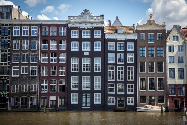
The canals of Amsterdam were added to UNESCO’s World Heritage List in 2010 as an example of town planning that influenced the world for centuries. But when they were first built in the 17th century, they weren’t meant for inspiration – they were critical to the survival of the city.
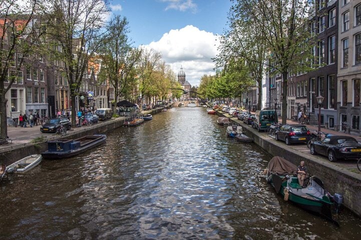
The first use of the canals was to clear the land of swampy water so that it could be developed as a city. They also had the added benefit of providing protection for the new residential and commercial areas of Amsterdam, which was the largest urban expansion of the time.

Defence Line of Amsterdam
In the 20th century, the Dutch looked at further protection of Amsterdam with more than just the city’s canals.
They had been clearing water from the land around the region for generations, and so the idea was to reverse this process. They created a system where they could flood the land and stop enemies from advancing (this was before the invention of military planes).
To achieve this, the Dutch built what is now called ‘The Defence Line of Amsterdam’ or ‘Stelling van Amsterdam’. It was a rough circle stretching for 135 kilometres all around the capital city and the important settlements nearby, with a radius of about 15 kilometres.
Along the line were built 45 armed forts, which were to be the key to operating the barrier if war came too close for comfort.
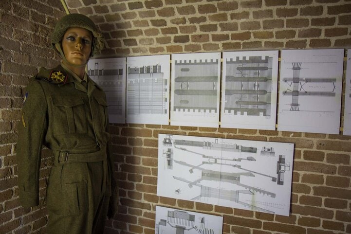
In basic terms, the defence program would use hydraulics to open gates and pump water from canals into low-lying plains, covering roads and land that an enemy would have to use to get to Amsterdam.
Some of the water would be too shallow to use boats, while the deeper areas were protected by the forts, which were armed with cannons and other artillery.
There are many sites along the line that you can visit today. All are accessible from Amsterdam but it would not be possible to see them all in a day. One of the most impressive is Pampus Island, which is accessible by boat.
Beemster Polder
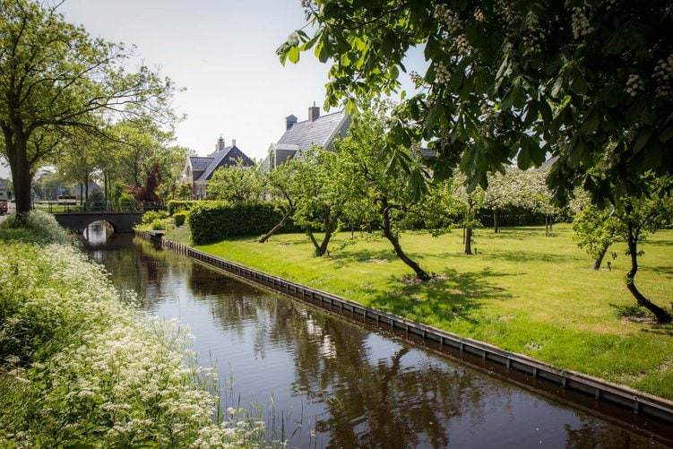
The clearing of water from swampy land started in the Netherlands hundreds of years ago. The technology at the time was revolutionary and was so good, in fact, that much of it is still used today with only minor improvements.
One of the best examples of this land reclamation is in an area called the Beemster Polder.
In this area, fifteen networks of windmills were used to harness the power of the wind and operate large waterwheels, which effectively lifted the water out of the lake and into canals that then drained it away.
This was happening to some degree as early as the fifteenth century for the smaller lakes but it was in the seventeenth century it was advanced enough to drain this whole area.
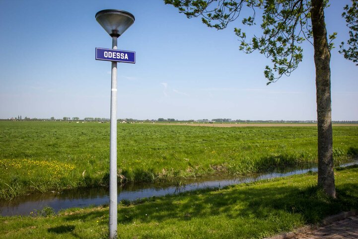
We’re talking here about a space as large as 70 km2 and, not surprisingly, it took a long time to drain the whole area with windmills. In fact, it took three years, to be exact, and the Beemster Polder was officially declared finished on the 19th of May 1612.
The centre of the polder is a small town called Middenbeemster. There is a basic museum here with some visitor information – but the real interest is the land around. It’s possible to take several walks from the town through the countryside.
Schokland and Surroundings
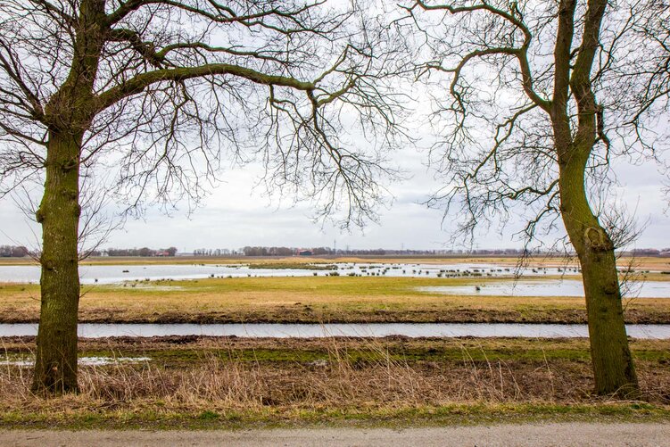
Another example of land reclamation can be seen around Schokland in the northeast of the Netherlands.
Schokland was originally an island and was a popular area for settlement in the Middle Ages. In the centuries that followed, though, the water level rose and the communities on the island were threatened.
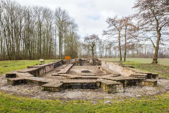
It was only in 1942 that the Noordoostpolder was reclaimed from the sea and the island became connected to the land again. You can still see how it is elevated above the fields around it. Officially, the former island of Schokland now has less than 10 inhabitants.
Schokland is an interesting area to explore, even though it doesn’t seem to have much at first glance. There are pleasant walking paths that take you through the beautiful landscapes, with opportunities to look for wildlife.

D.F. Wouda Steam Pumping Station
The original system of land reclamation in the Netherlands centuries ago involved systems of windmills and canals. This technique is still used in some parts of the country but more recent projects have adopted modern technology.
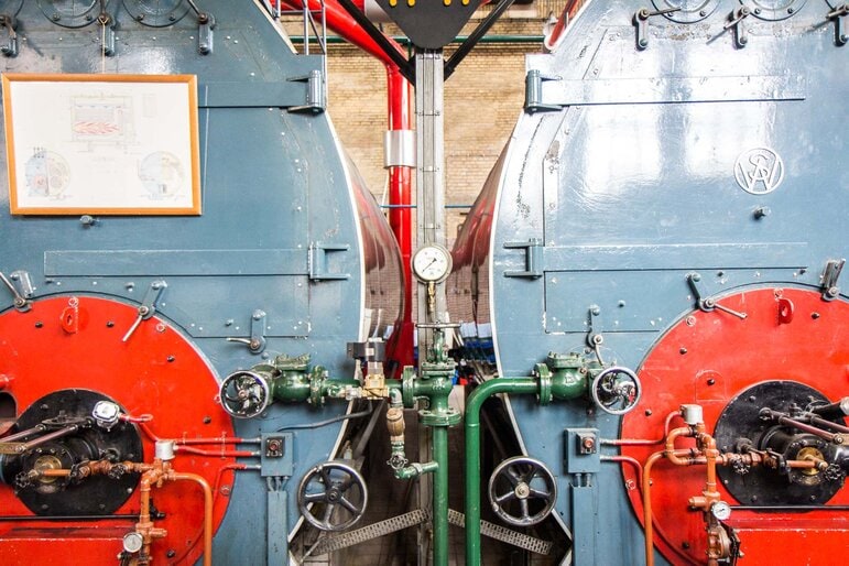
The best example of these technological advances can be seen in the D.F. Wouda Steam Pumping Station.

The pumping station is located in the north of the country near a town called Lemmer. It was opened in 1920 and is today the largest still operational steam-powered pumping station in the world.
Originally, it ran on coal but was updated in the 1960s to run on oil. It is only used occasionally to supplement other pumping facilities.
When you visit the D.F. Wouda Steam Pumping Station, you’ll be able to go on a guided tour of the pumping station and learn all about how it works. The technology is interesting, but it’s really the stories of the people who worked here that make it such a fascinating site.
Mill Network at Kinderdijk-Elshout
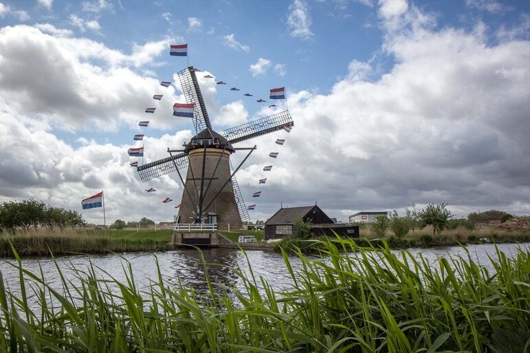
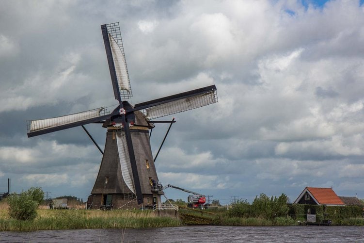
Just a short journey by boat or road from Rotterdam are the windmills of Kinderdijk. They have become a popular tourist attraction because they look like every Dutch cliche that foreigners expect and because they are so easily accessible.
Like many of the other World Heritage Sites in the Netherlands, this one is about water removal. There are 19 actual windmills here that are heritage-listed these days but at the height of the region’s productivity in the eighteenth century, there were about 150 of them.
They use an extremely advanced (for the time) technique which moves water from the fields into a reservoir. For a part of the country which is constantly flooded, it’s the only way the land can be used for farming.
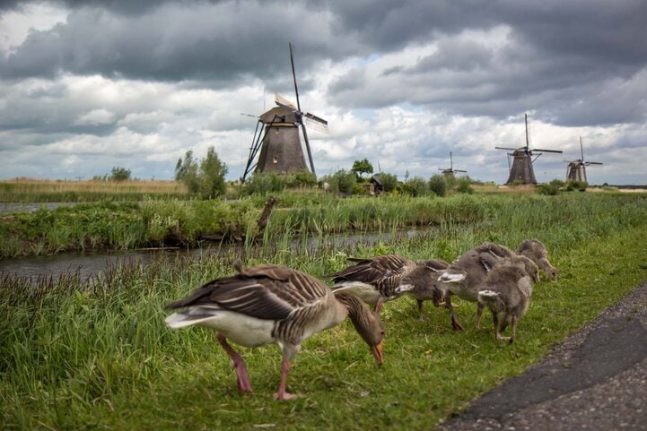
In about 1950, modernity caught up with Kinderdijk and a different system of controlling the water was installed in the area… but the windmills have stayed operational, just in case. Many of them are still lived in, and on a windy day, the sails are let loose to cut through the air like they used to.
To visit the mill network, the most enjoyable way is to get one of the regular boats from Rotterdam, which includes a river cruise along the way.
Van Nelle Factory
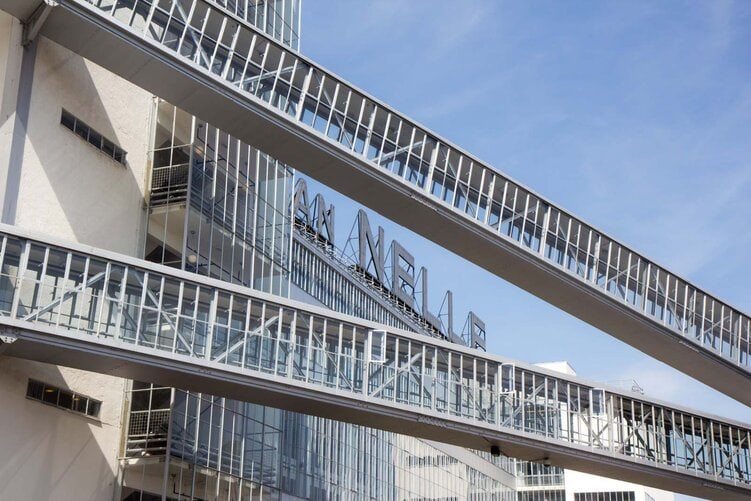
The Van Nelle Factory on the outskirts of Rotterdam was built in the 1920s and was considered to be revolutionary for its time. In 2014, it was added to the World Heritage List to recognise the impact it had on modern architecture.
From the outside, large glass windows, steel, concrete and a mix of right angles and curves create a flowing structure that merges the factory and its environment. Inside is where the most innovative elements lie, though.
There’s a humanist approach within a traditional corporate structure – shower blocks, a free-flowing workspace, natural light, and gardens around the exterior.
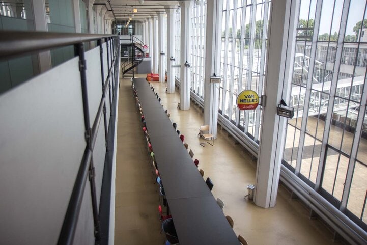
These days, the Van Nelle Factory building is used as office space for small companies. It is possible to visit it but only as part of prearranged tours.
Rietveld Schroder House
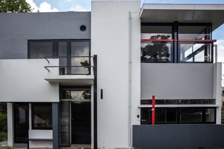
Another architectural treasure has been named a World Heritage Site in the Netherlands. It’s known as the Rietveld Schroder House and is located in the city of Utrecht.
It’s a small residence that was designed and built in the 1920s. It took a completely new approach to architecture, and the emphasis was on maximising space and using the same area for different purposes throughout the day.
It also aimed to connect the interior with the environment outside through large glass windows and unorthodox shapes.
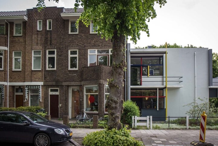
At first glance, the Rietveld Schroder House looks strange. That’s because it is essentially one open space (apart from the toilet and bathroom). There are beds in the corners which have a direct view to the dining table and the other beds.
There’s no clear sense of where the living area stops and the sleeping areas begin. In fact, it seems like they can be one and the same.
The house is now part of Utrecht’s Centraal Museum and is open to the public through regular guided tours.

The Wadden Sea
The Wadden Sea is in the southeastern part of the North Sea. It is the only natural World Heritage Site in the Netherlands and has been listed because of the special environment that has been created by the sandbars, tidal channels and wetlands.
It is the largest unbroken system of intertidal mud and sand flats in the world.
The site is shared between the Netherlands, Denmark and Germany. It is possible to visit it from any of the countries and some vantage points offer views of large mammals like seals.
The small animals that make up the unique ecosystems are also just as interesting and demonstrate relationships in intertidal landscapes where the environment changes constantly throughout the day.
Historic Area of Willemstad, Inner City and Harbour, Curacao
The city of Willemstad was founded by the Dutch in 1634 on the Caribbean island of Curaçao. The island was captured from the Spanish and the new settlement was to become the capital of not just the island but the whole Dutch Antilles until the dissolution of the country in 2010.
The inner city and the harbour were listed as a World Heritage Site in 1997 because of its architectural style and development of a trading settlement. It applied design principles of European urban planning to an area that grew as a multicultural community over the centuries.
Because of its location, I haven’t visited it yet – but hopefully, I’ll be able to get there one day soon and complete this list of the World Heritage Sites of the Netherlands
I hope a few of these locations give you some inspiration for your next travels. As you can see, there are lots of interesting places to visit in the Netherlands.



Hi Michael.
Some great suggestions, but there are many more. Keukenhof is a defenet MUST if you are in the Netherlands in spring and Zaanse Schans windmill village provides a one stop Dutch experience.
If I may share the link to our trip? https://www.twoguysabroad.com/amsterdam-travel/
Safe travels 😉
Donovan